Florida Keys National Marine Sanctuary Map Library
The following collection presents a library of topical maps available for Florida Keys National Marine Sanctuary.

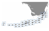
Florida Keys National Marine Sanctuary
Boundary (pdf, 343 kb)
This simple map outlines the boundaries of the sanctuary in relation to south
Florida. It does not show the boundaries of individual marine zones, or the
boundaries of other state or federal areas.

Florida Keys National Marine
Sanctuary and South Florida (pdf,
1.8 MB)
This colorful, high resolution map shows the boundaries and marine zones
of the sanctuary, as well as those of other state and federal partners
in south Florida. This map is part of a comprehensive
atlas of the national marine sanctuaries.

Florida Keys National
Marine Sanctuary and Zone Boundaries (pdf, 416 kb)
This map shows the boundaries of the sanctuary and its marine zones, as
well as the boundaries of adjacent parks and refuges differentiated by
color.

Florida Keys National Marine Sanctuary Marine Zones
The sanctuary uses a management strategy called marine zoning to set aside
parts of the ocean for specific uses and protect special areas. Use this interactive
map to learn more about the locations of the marine zones of the sanctuary,
the types of resources they protect, and their special rules. More…
Benthic Habitats of the Florida Keys
Mapping of benthic — or seafloor — habitats help sanctuary mangers develop strategies to balance the use and protection of those habitats. The Unified Florida Reef Tract Map provides a consistent framework for management, monitoring, and characterization of the Florida reef tract from Martin County to the Dry Tortugas. Learn more about how the detailed classification scheme integrates multiple mapping and monitoring projects at The Unified Floride Reef Tract Website. Or, simply view map online here at Unified Reef Map.

Buoys within Florida Keys National
Marine Sanctuary
Mooring buoys provide boaters with an alternative to dropping anchor
and are a management tool to protect coral reefs. Headed out on the water
and want to know which sites in the sanctuary have mooring buoys? This
interactive map shows where the mooring buoys are in relation to popular
reef sites, artificial reefs and shipwrecks. More…

Florida Keys National Marine Sanctuary Shipwreck Trail Sites
The nine ships of the sanctuary’s Shipwreck Trail are located just a few miles
offshore have tales to tell to divers and snorkelers alike. Visit this interactive
map to view locations of these historic wrecks, access information on wreck
history and archeology, and view site maps. More…