Historic Beacons Warned Wayward Sailors
May 2016
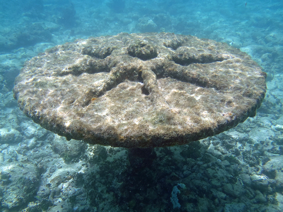
 This disc-like flange, located on several beacon piles, was possibly a turning mechanism. Photo credit: T. Hitchins. Click for high resolution image
Beginning in the fifteenth century, European exploration and colonization of the Americas brought increasing numbers of voyagers along the shores of the Florida Keys and within reach of the treacherous reefs that bound the western side of the Florida Straits. The next several centuries saw the ruin of hundreds of vessels transiting this seaway. Even in calm weather sailing vessels of this period were at the mercy of the Gulf Stream; the incredibly strong current pushed ships onto the reef when wind conditions were unfavorable.
The 1789 Lighthouse Act authorized installation of lighthouses and other aids to navigation at dangerous points on the American coast to guide vessel traffic safely to port and away from submerged hazards. Following Florida’s admittance to the Union as a territory in 1821, increasing traffic between gulf ports and the eastern seaboard brought mounting financial losses from shipwrecks in Keys’ waters. Merchant ship owners focused pressure on the U.S. government to take action to prevent shipping losses. The Florida Keys iconic lighthouses are a highly visible reminder of this effort, but were not the only techniques used to prevent shipwrecks.
Beginning in 1849, the U. S. Coast Survey, a predecessor agency of the National Oceanic and Atmospheric Administration, spent more than 30 years in the Keys mapping and marking the reefs. By 1853, construction began on unlit markers, labeled alphabetically from "A" through "P," that worked something like signposts to indicate reef positions to mariners. These would become known as the “Totten Beacons” after Lieutenant James B. Totten, the U.S. Army Assistant to the Coast Survey who oversaw their construction. Totten reported to his superiors that he had installed 14 of the 15 planned beacons by July 1855.
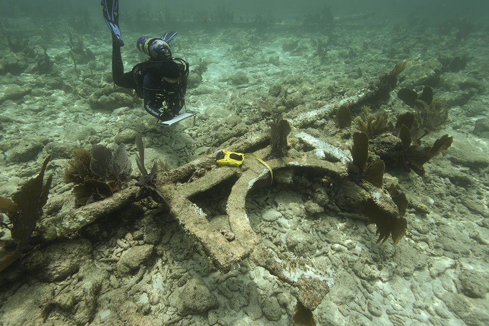
 This researcher is recording the French Reef beacon pile and remains of letter "G". Click for high resolution image
Through a grant from NOAA’s Preserve America Initiative, the Office of National Marine Sanctuaries has begun a comprehensive survey of the “Totten Beacons” and developed a website to convey the importance of the U.S. Coast Survey’s efforts to protect life and property in the Florida Keys. Supported by NOAA’s Office of Coast Survey and the NOAA Central Library, staff and volunteers from Florida Keys and Stellwagen Bank national marine sanctuaries and the Mel Fisher Maritime Heritage Society compiled historic information and documented beacon remains at five reefs: Eastern Sambo, American Shoal, Pickles Reef, French Reef, and Turtle Reef. Their research is now available on the Florida Keys National Marine Sanctuary website with site maps, 3D models, and biological surveys.
To learn more about early aids to navigation and the “Totten Beacons” visit floridakeys.noaa.gov/historic-navigation-aids/welcome.html or contact Brenda.Altmier@noaa.gov.


