Update on the status of Florida Keys National Marine Sanctuary
October 2017
Announcements
ESF 10 News Releases
09/29/2017 Unified Command begins removal process for vessels displaced by Hurricane Irma
09/27/2017 Best practices for removal of vessels
09/27/2017 Emergency Support Function 10 Release
Sanctuary Superintendent Statements
09/26/2017 Florida Keys National Marine Sanctuary assesses impact of Hurricane Irma
09/14/2017 Florida Keys National Marine Sanctuary offices closed due to Hurricane Irma
09/08/2017 Hurricane Irma poses significant threat to Florida Keys National Marine Sanctuary
Community Announcements
10/06/2017 Civil Air Patrol assists in locating buoys in the Florida Keys National Marine Sanctuary
10/06/2017 Florida Keys National Marine Sanctuary enlists public's help in post-hurricane survey
09/26/2017 Florida Keys National Marine Sanctuary seeks lost buoys after hurricane
09/26/2017 Florida Keys Eco-Discovery Center reopens following Hurricane Irma
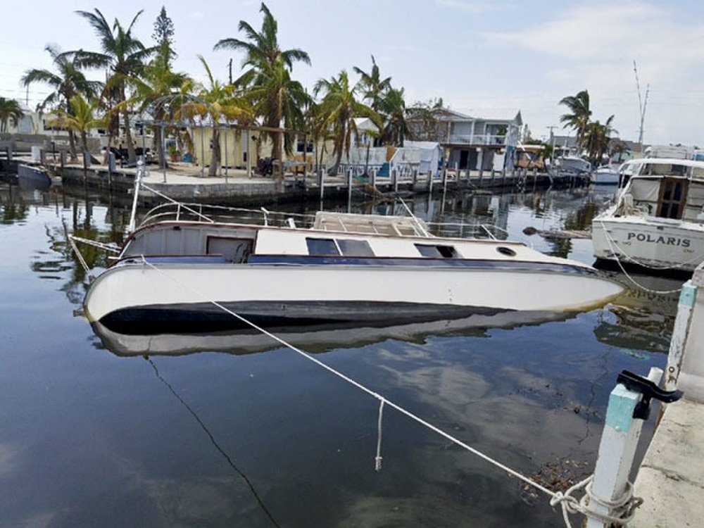
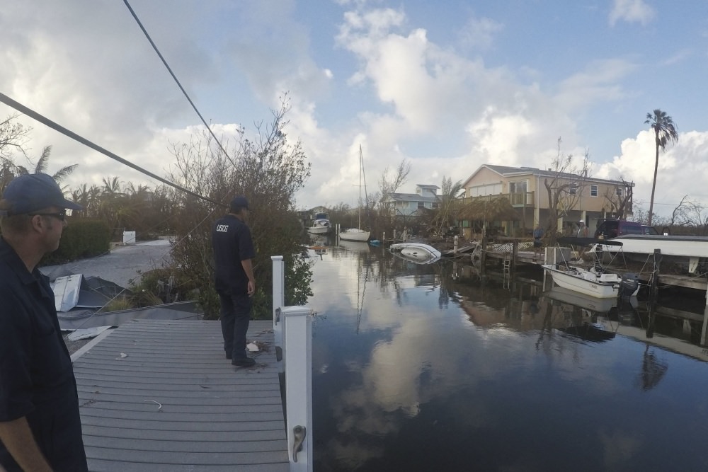
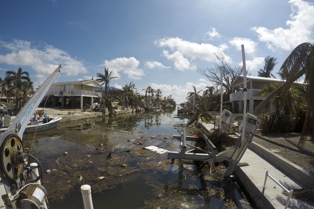
Vessel assessments, pollution mitigation in the wake of Hurricane Irma
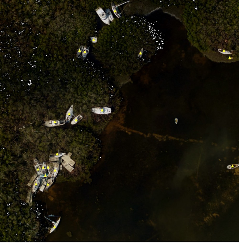
Hurricane Irma Aerial Images
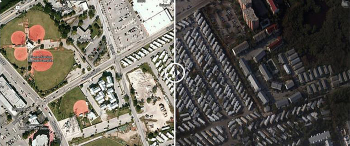
Additional flights are scheduled and photos from those missions will be posted as soon as possible.
Aerial images available at: https://storms.ngs.noaa.gov/storms/irma/index.html
Sand Disturbed by the Passing of Hurricane Irma
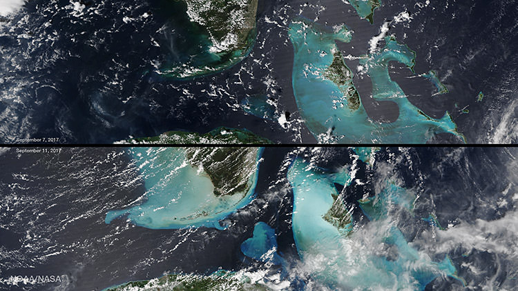
Larger version available at: https://www.nnvl.noaa.gov/MediaDetail2.php?MediaID=2101&MediaTypeID=1
Additional Information
Hurricanes: Friend or foe to coral reefs?